
Buckeye Previous Resident Sources
An address history has two linked trails. The ownership trail starts with the parcel and moves through deeds. The household trail uses sources that place named people at the site. Begin with the era nearest the event. A modern subdivision is best opened with the assessor and permits, while a downtown Buckeye property may also lead to a telephone directory, census schedule, newspaper, or rural route.
| Source | Verified reach | Where held | What it shows |
|---|---|---|---|
| Recorder deeds | County responsibility since 1871; online depth varies | Maricopa Recorder portal, counter, and deed books | Title transfers, parties, legal description |
| Assessor and GIS | Current parcel with selected sale and history fields | Maricopa Assessor and Parcel Viewer | Owner, APN, situs, mailing address, deed link, construction year |
| Buckeye directories | Verified editions in 1916, 1936, and 1949–50 | Arizona Memory Project, State Research Library, catalog partners | Listed subscriber, spouse, occupation, address, and some tenure context |
| Federal census | Public population schedules through 1950 in 2026 | National Archives and partner databases | Household members, relationships, place, and personal details |
| Permit archive | Modern portal; older reach is request-dependent | Buckeye Development Services | Construction dates, project details, applicants, and site evidence |
| Historic newspapers | Buckeye titles digitized from 1912 through 1950 | Library of Congress and partner collections | Visits, deaths, marriages, clubs, events, and address clues |
The table is not a claim that each source is complete. Deed records can predate a building by many years. A directory can omit a household. Permit records may identify an applicant or contractor rather than an occupant. Keep those limits beside every name.
Start Buckeye Resident Address History
The current Maricopa Assessor card translates a street address into durable record keys. Save the assessor parcel number, known as an APN, plus the owner name, physical or situs address, mailing address, subdivision and MCR, deed date and number, sale details, and construction year. The situs address marks the property location. The mailing address is where tax mail goes, and it may belong to an owner elsewhere.
That difference is vital when looking for previous residents. Matching mailing and situs addresses may support owner occupancy, but it does not prove it. A trust or company may appear as owner. A former non-owner occupant may never enter the parcel card. If a current APN no longer traces backward because a parcel was split or combined, ask the Assessor for a parcel-history report.
A concise process is: street address → current parcel → APN and legal description → current deed → prior deed parties → directory or census occupants. The Buckeye street directory handles the current by-address record chain in more depth.
Buckeye Previous Residents Deed Chain
The Maricopa County Recorded Document Search is indexed mainly by a person or business name, not by an old street address. Start from the deed number on the parcel card. The image can name the grantor, grantee, legal description, return address, and recording details. An unofficial image is useful for research; a paid official or certified copy serves a different purpose.
- Open the current parcel card and copy its APN, subdivision, MCR, legal description, owner, and deed number.
- Retrieve the latest deed. Record all grantors, grantees, dates, document number, and exact land description.
- Search the seller, who is the grantor in that deed, as a grantee before the current transfer date.
- Compare the legal description and document links. Do not join two transfers just because a name matches.
- Repeat until the online index or images become incomplete, then use Recorder staff, the Phoenix counter, mail service, or deed books.
The Recorder says county recording responsibility reaches back to 1871. That does not mean every historic image and index field is online. The full-text Research mode only covers the last two years, so an address phrase that works for a new instrument will not search the full deed history. Older research depends on name, document number, book and page, MCR, or an offline index.
- Grantor and grantee
- The grantor gives an interest; the grantee receives it in the indexed instrument.
- Chain of title
- The linked sequence of recorded transfers for the same legal parcel.
- Legal description
- The recorded land identity, often based on lot, block, plat, or survey rather than a street label.
- MCR
- A Maricopa County Recorder map reference that helps connect a subdivision and parcel to its recorded plat.
Buckeye Previous Residents Deed Detours
Trusts, companies, marriages, name changes, quitclaims, and trustee's deeds can interrupt a simple surname trail. Search a trust, association, HOA, or subdivision in the Recorder's Business Name mode. Try individual name variants separately, including initials and compound surnames. Then use the legal description, recording date, and document number to decide whether the result belongs to the same Buckeye parcel.
A quitclaim can move an interest without an ordinary market sale. A deed into a family trust may keep the household in place even though the indexed owner changes. A trustee's deed can mark a different type of transfer. Each one is a title event, not automatic evidence that a past resident moved on that date.
The record volume is large. Recorder reports say more than 90 percent of documents in the first quarter of 2024 were recorded digitally. That helps explain why recent transfers can appear quickly. It does not make the historic path complete, and the free Maricopa Title Alert only watches names after enrollment rather than rebuilding the past.
Buckeye Records Date the Structure
Land ownership may be much older than the house. Use the assessor's construction year as a first time gate, then check Buckeye permits for construction, alteration, repair, demolition, pools, utilities, or other site work. Permit evidence can identify the address, parcel, work type, dates, status, owner, applicant, or contractor. None of those roles alone proves residence.
The public permit system did not yield an authoritative historic cutoff in the research. When an old project is absent, send a targeted request to Buckeye Public Records or Development Services. Include the exact address, APN, approximate year range, and any permit or project number. The city, not the county Recorder, holds municipal permit records.
Buckeye GIS maintains separate address, cadastral, locator, and addressing-reference layers. If a modern address conflicts with an old source, request the official address-point or change record. No verified citywide Buckeye street-renumbering event was found, so a changed number must not be assumed.
Note: Do not search for occupants in years before the structure existed without evidence of an earlier building on the parcel.
Link Buckeye Previous Resident Households
Deeds identify owners. Directories and census schedules are better evidence of named occupancy. The verified Buckeye-inclusive volumes are the 1916 Phoenix and Salt River Valley directory, the 1936 Mountain States Phoenix telephone directory, and Salisbury's 1949–50 North and West Maricopa County directory. The last one includes an alphabetical Buckeye section and a reverse section ordered by street and building number.
The collections themselves are documented on the Buckeye city directory page. For one address, use this pairing process:
- Choose the closest directory edition and copy the address exactly, including route, box, direction, and street type.
- Check both the name-order and reverse street sections; record the listed spouse, work, telephone, and occupancy-status marks.
- Match the 1949–50 directory clue to the public 1950 census, using names, ages, family ties, and location.
- Compare the directory household with the deed owner. Preserve any difference instead of forcing them to match.
- Use an obituary, probate file, cemetery entry, or later news item when a person disappears from the next source.
The newest public federal population census in 2026 is 1950 because schedules open after 72 years. The 1960 census is scheduled for public release in 2032. A directory publication date may also lag its canvass, so a move can fall between the date printed on a book and the day the facts were gathered.
Buckeye Previous Residents Census Access
The National Archives census research portal explains federal schedule access and the 72-year release rule.
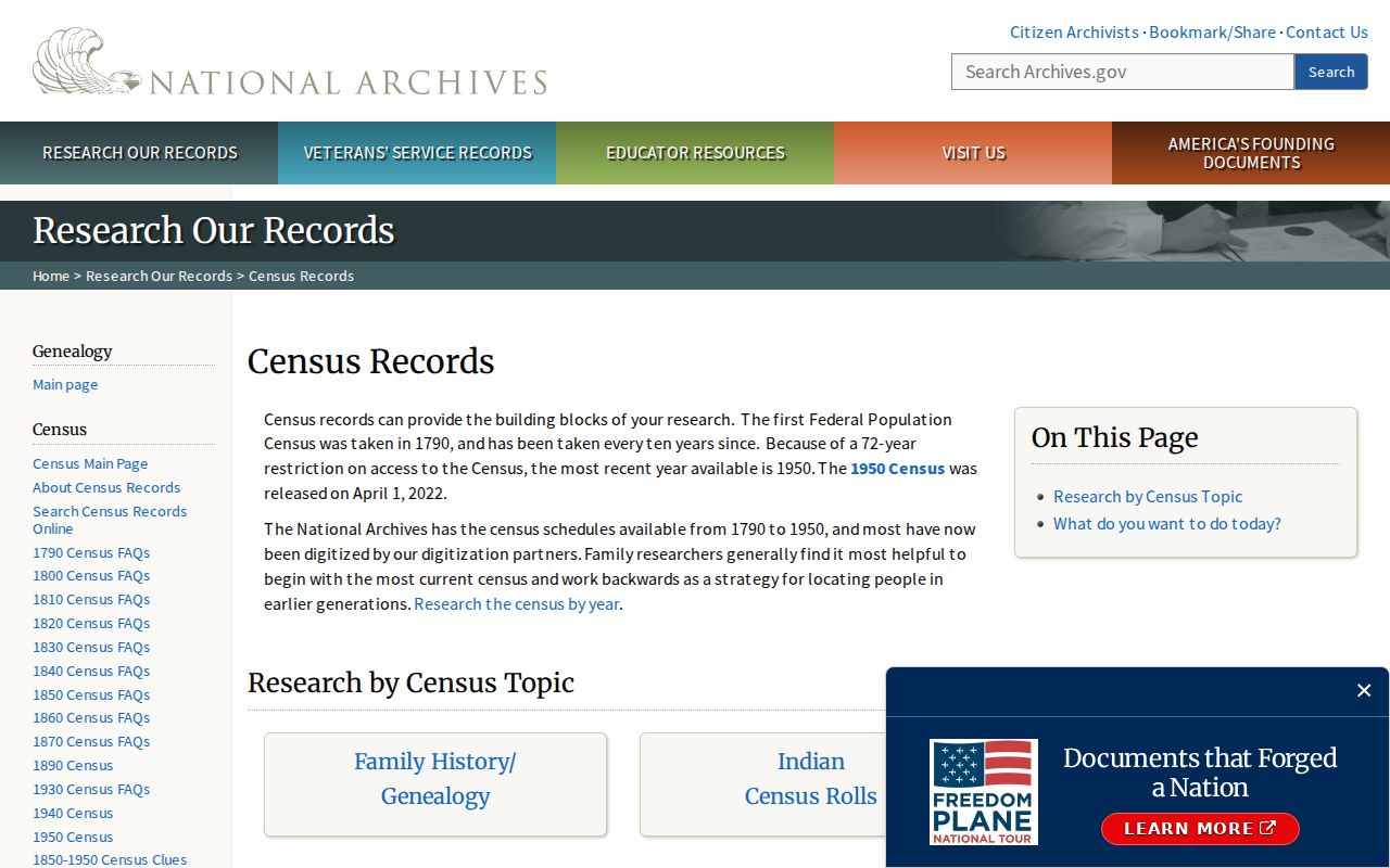
The portal establishes the official release framework; name indexes and schedule images may be reached through archive partners or library databases.
Enumeration geography can be harder than the name. An enumeration district is the area assigned to a census worker. Buckeye's old rural routes, nearby communities, and later annexations may place the expected household outside a modern city-shaped search. Use a directory address, route, or nearby name to test the schedule.
Close Buckeye Resident Trails
For a deceased past resident, probate, obituaries, cemetery evidence, and historic vital images can close the trail. The Arizona genealogy certificate search offers free noncertified images once the statutory interval passes. The portal labels birth coverage 1855–1945 and death coverage 1870–1970, while Arizona law opens genealogy images after 75 years for births and 50 years for deaths.
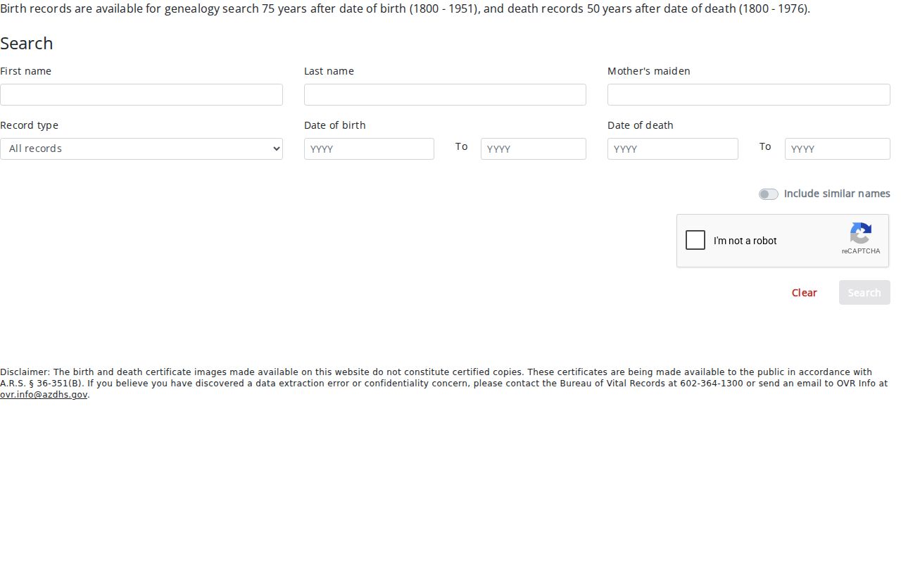
The image shows the genealogy search route, which is distinct from ordering a current certified birth or death record.
Probate files and obituaries can name relatives, heirs, former homes, or the date a household ended. They should still be tied back to the right person with a middle name, date, spouse, parcel, or case number. Current vital certificates remain restricted to eligible applicants and are not public resident indexes.
Buckeye Previous Resident News Gaps
The Buckeye Valley News and successor titles provide a local named-person record between sparse directory editions. Digitized issues run from February 1912 through September 1950 under three related titles. Notices can mention marriages, deaths, visitors, school events, church activity, clubs, local firms, and farm or irrigation matters. Search the OCR with several surname spellings, then inspect the page because old type often defeats name and address recognition.
The paper's reach includes Liberty, Palo Verde, and Arlington. A social notice in a Buckeye paper is not automatic proof that the subject lived inside current Buckeye limits. It is a lead to compare with the census, deed, directory, or probate evidence.
Pre-1910 searches should also test Sidney. Buckeye was platted under that name in 1888, standardized as Buckeye in 1910, and incorporated in 1929. County recording dates to 1871, so the owner trail can precede both a municipal government and a stable modern street address.
Limits on Buckeye Previous Residents
Buckeye previous residents cannot be reconstructed as a perfect household roll. Property records favor owners. Telephone and city directories omit unlisted people. The census is closed for recent decades. Association rosters and utility accounts are generally private. Arizona's Address Confidentiality Program and other protected-address rules must be respected.
A Sanborn map can document a building footprint, use, construction, and an old street label, but it does not name occupants. No verified Buckeye Sanborn year series was located. Browse the Library of Congress collection by place and date before citing one, and pair any sheet with a directory, census, or deed.
Lawful use. Buckeye house history and family research are legitimate personal uses. Never use an address trail to stalk, threaten, harass, or defeat a protected address.
Stop where the sources stop. A clearly labeled gap is more useful than an unsupported name, date, or claim about who lived here before.