
Buckeye Residents by Block
A Buckeye neighbors search joins public geography with records about parcels and public roles. It cannot produce a full roster of nearby households. The Maricopa County Parcel Viewer can select nearby lots and expose parcel fields. The Assessor confirms each titled owner and distinguishes the property's physical, or situs, address from the owner's mailing address. Buckeye maps clarify whether adjacent homes share city, council, police, voting, or community-facilities boundaries. Permits and association contacts answer narrower questions.
| Source | What It Shows About a Block | Access |
|---|---|---|
| Parcel Viewer | Lot outlines, owner, situs, mailing, subdivision, and deed fields | Free map selection; 1,000-result cap |
| Assessor search | One parcel's owner, APN, address, and property facts | Free portal; owner may not occupy |
| Buckeye map gallery | City limits and service or district geography | Free interactive maps and PDFs |
| Permit record | Work, applicant, contractor, status, and dates at a lot | Portal or targeted city request |
| Community association | Voluntary public board, event, or contact details | Public page; member rosters usually private |
Ownership and occupancy are not synonyms. Matching mailing and situs addresses may support an owner-occupancy inference, but the assessor does not list every person at a home. A trust or company can hold title. Non-owner occupants and other household members may never appear on the parcel card. Keep the language precise: the official sources identify parcels, owners, districts, and public contacts around a Buckeye address.
Note: A parcel map is an owner-and-land record, never a complete list of the people who share a block.
Shape a Buckeye Block Lookup
The Maricopa County Assessor Parcel Viewer documents point, line, polyline, extent, circle, polygon, and freehand-polygon selection. A search can replace, add to, or remove from the current result set. Its buffer control expands a selected graphic by a chosen distance. These tools make the immediate block visible without sweeping in a whole subdivision.
Results stop at 1,000 features. That number is useful as a warning: a wide circle is not a sharper block search. It can pull unrelated parcels across arterial roads, subdivision edges, or service districts. Keep the shape tight, inspect each Feature Information panel, and record the APN before moving to the Assessor or a recorded deed.
- Parcel
- A legally described unit of land identified by an assessor parcel number, or APN.
- Situs address
- The physical address assigned to the parcel, distinct from the owner's mailing address.
- Buffer
- A map zone drawn at a set distance around a point, line, or shape.
- MCR
- A Maricopa County recording reference used with subdivision, lot, block, or tract details.
Map Buckeye Residents and Parcels
When mapping Buckeye neighbors, begin with one deliverable address. The process moves outward only far enough to define the immediate block, then moves back into parcel-level records. That keeps nearby lots separate from distant owners who happen to share a postal ZIP or master-plan name.
- Locate the target in Parcel Viewer by address or APN. Zoom until individual lot boundaries are clear.
- Draw a small extent or polygon around the adjacent lots. A narrow buffer can work when a block has an irregular edge.
- Open each result. Save the APN, situs address, owner, mailing address, subdivision, deed reference, and jurisdiction fields.
- Check the Assessor record for each selected parcel. Treat a matching mailing address only as a clue that the owner may occupy it.
- Use the city map gallery for district and boundary context. Expand to the Buckeye street directory only when the task truly concerns the full named street.
Parcel Viewer fields can also include deed date and number, sale information, construction year, zoning, and jurisdiction. Those fields bridge a lot to the right office. They do not make the map a household list.
Buckeye Block District Layers
A street can cross more than one public-service geography. The Buckeye GIS and map gallery publishes city limits, annexation history, council districts, police districts, voting geography, parks, streets, trash and recycling areas, community facilities districts, and approved community master plans. These layers explain which public body may hold a record for one side of a road.
Postal Buckeye and incorporated Buckeye are different shapes. An address can carry the Buckeye postal label yet fall outside city limits. Check the municipal boundary before directing a permit, code, or city-service question to Buckeye. For an incorporated lot, a targeted city request can identify a permit by address, APN, and approximate year when the online portal does not surface it.
Permit records may identify an owner, applicant, contractor, parcel, project scope, issue date, status, or inspection. They remain project evidence, not proof of every neighbor at the site. Code complaints can also withhold or redact personal details.
Buckeye Resident Community Contacts
Buckeye neighbors often share a planned-community name. City materials commonly use Verrado, Sundance, Festival Ranch or Sun City Festival, Tartesso, and Blue Horizons. Searching a subdivision or association name can locate a public plan, plat, district, board contact, event, or city engagement channel. These names are especially useful when a street address alone fails in the Recorder's Business Name mode.
Buckeye Neighborhood Services
City engagement and neighborhood resources. Public contact information supports civic questions, not a resident roster.
Community Associations
Public board officers, meeting notices, and contact pages may be available. Membership lists usually remain private.
Buckeye Public Library
Local databases, newspapers, and in-library genealogy access can support a voluntary or historical connection.
Buckeye Valley Museum
Local history, photographs, and oral histories can explain a neighborhood's past without serving as a current directory.
Neighborhood watch, congregation, school, club, and chamber lists are voluntary or role-based. A public officer or business member is not the same as every person nearby. Contact the organization through its own published channel and respect any closed roster.
Historical sources can explain how an older Buckeye block was known without naming its current households. The Library of Congress documents digitized Buckeye Valley News issues from 1912 through 1950 across three related titles. The paper covered Liberty, Palo Verde, and Arlington as well as Buckeye, so every place mention needs context. OCR, or optical character recognition, can miss names and street text. Search a surname or subdivision, then inspect the page image before relying on a match.
The 1949–1950 Salisbury directory offers another period layer, including a reverse street section for Buckeye. It can identify the listed subscriber or occupant in that edition. It cannot establish a current household. The State Research Library, Buckeye library databases, and museum collections are the proper fallback when the digitized run lacks the needed year.
Note: A community name is a strong subdivision search key, but it is not proof that every nearby lot shares one association.
Buckeye Residents in Public Roles
Business filings sometimes clarify why a familiar community or association name appears on a deed, plat, or public notice. The Arizona Corporation Commission eCorp search can be queried by entity name, entity ID, statutory agent, or principal name, with type and status filters. It can show the legal entity name, formation information, known place of business, public agent, and filing history.
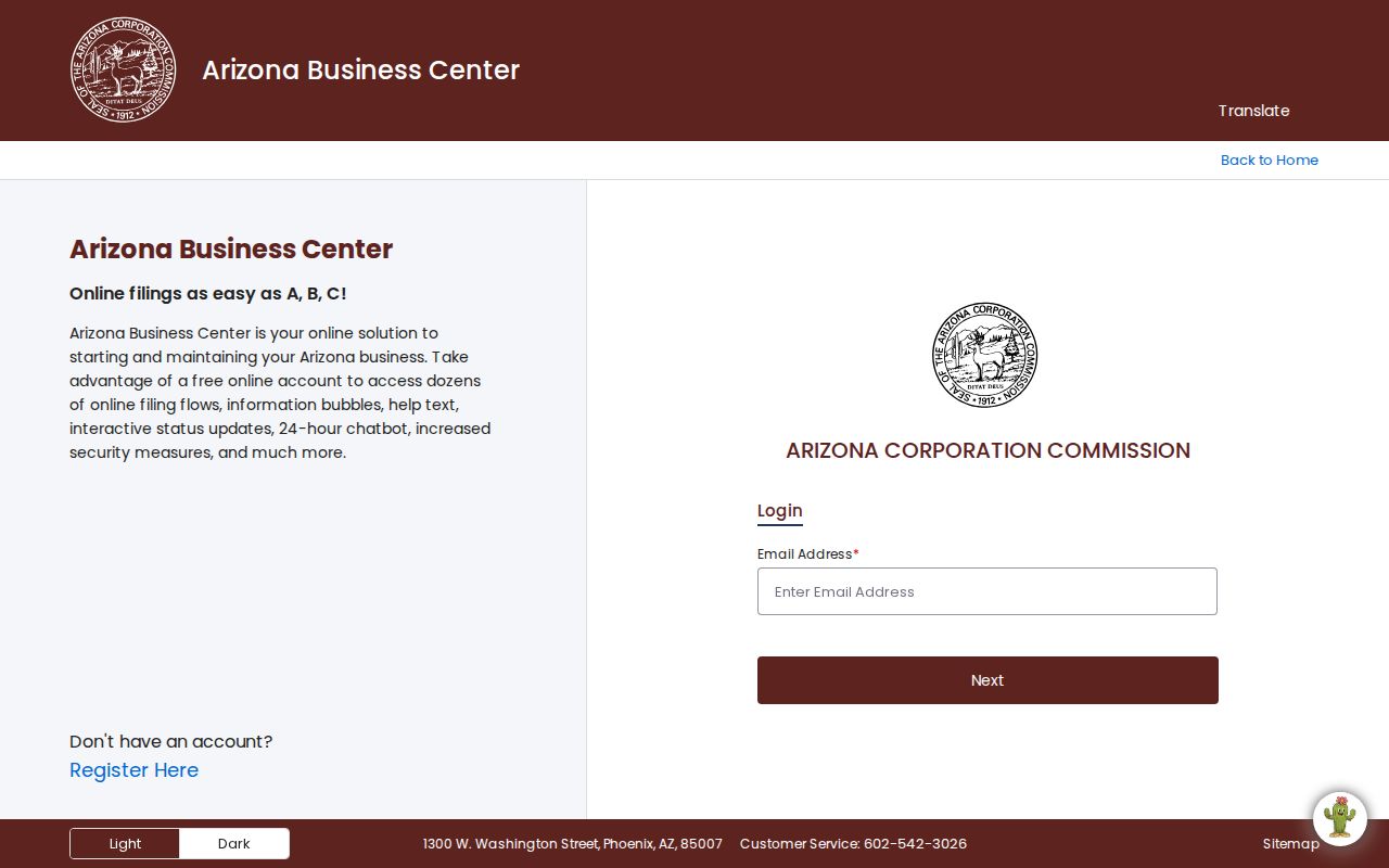
The entity screen helps connect an HOA or community name to its public filing. It does not prove that an agent or officer lives on the block.
Use a stable entity ID when names are close. A planned community may have several entities for an association, community facilities district, development company, or service body. Record the role and address exactly as filed, then return to the parcel or city record that led to it.
Buckeye Resident Voter Boundaries
Arizona voter records cannot power a general list of people on a Buckeye block. The individual portal checks a person's own registration and polling information. Separate voter-list access is controlled by A.R.S. §16-168 and limited to authorized political, party, campaign, election, redistricting, or other specified purposes. Internet redistribution is prohibited.
The statute also protects sensitive fields, including signatures, email addresses, government identifiers, and exact birth components. Protected registration records remain unavailable. The official A.R.S. §16-168 text shown below is the controlling source for those boundaries.
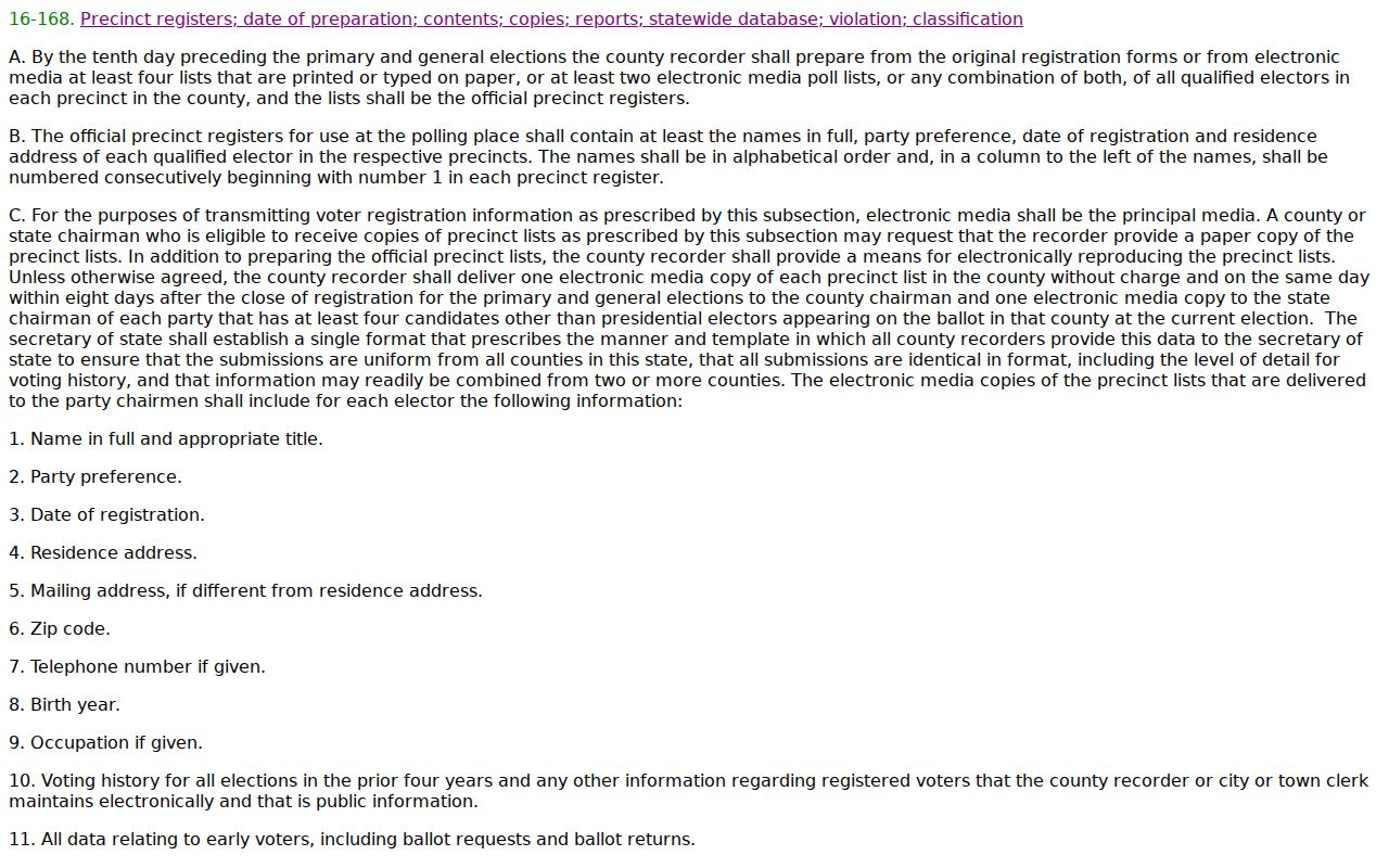
The law confirms why a voter list is not an open block-browse tool. Property GIS and voluntary community sources are the lawful general-public path.
Compare Buckeye Block Sources
Official rolls and commercial neighbor tools are built for different purposes. The official source is narrower but states which office holds the data and what each field means. A compiled commercial result may blend public, marketing, and older data without showing why one person or address was linked.
| Source Type | Useful Evidence | Main Limit |
|---|---|---|
| Assessor and GIS | Parcel, owner, situs, mailing, subdivision, and jurisdiction | Not a list of occupants |
| City and association pages | Districts, public officers, events, and contacts | Rosters may be private or voluntary |
| Commercial compilation | Possible lead assembled from several sources | Can be stale, merged, or mislabeled |
Confirm any useful clue in the original custodian's record. Never use a compiled result to defeat a protected address, closed roster, or statutory restriction.
Note: Official sources are narrower than commercial compilations, yet their custodians, field meanings, and correction paths are clear.
Privacy for Buckeye Residents
A lawful search for Buckeye neighbors respects Arizona's Address Confidentiality Program, which supplies a substitute address and mail forwarding to eligible protected people. Protected voter addresses must also remain hidden. A blank or substitute address is a firm stop, not a prompt to rebuild the location from other records. Utility accounts, delivery records, private association rosters, non-owner occupants, and unpublished household members remain outside a legitimate block search.
Use public block records for civic curiosity, property context, reconnection, or personal safety. If a record appears wrong, take the APN, document number, permit number, or other stable ID to the custodian. The correction belongs at the source. Do not publish a guess about who lives at a Buckeye address.
Lawful use. Buckeye neighbor records support lawful personal research. Arizona law prohibits using them to watch, stalk, harass, threaten, or intimidate anyone.